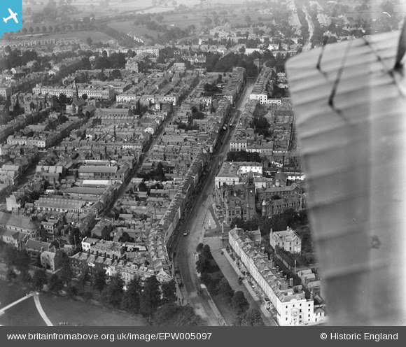
EPW005097 ENGLAND (1920). The Parade and environs, Royal Leamington Spa, 1920
© Copyright OpenStreetMap contributors and licensed by the OpenStreetMap Foundation. 2024. Cartography is licensed as CC BY-SA.
Nearby Images (19)
EPW005097

EPW005092

EPW053222

EPW001219

EPW005096

EPW005095

EAW003637

EPW001214

EPW005093

EPW053225

EPW001217

EPW005098

EAW024688

EPW005091

EPW019736

EPW000414

EAW003636

EPW005094

EPW053220

Details
| Title | [EPW005097] The Parade and environs, Royal Leamington Spa, 1920 |
| Reference | EPW005097 |
| Date | October-1920 |
| Link | |
| Place name | ROYAL LEAMINGTON SPA |
| Parish | ROYAL LEAMINGTON SPA |
| District | |
| Country | ENGLAND |
| Easting / Northing | 431767, 265860 |
| Longitude / Latitude | -1.5342080173245, 52.289563907732 |
| National Grid Reference | SP318659 |
Pins
 Class31 |
Tuesday 31st of May 2016 01:42:58 PM |