
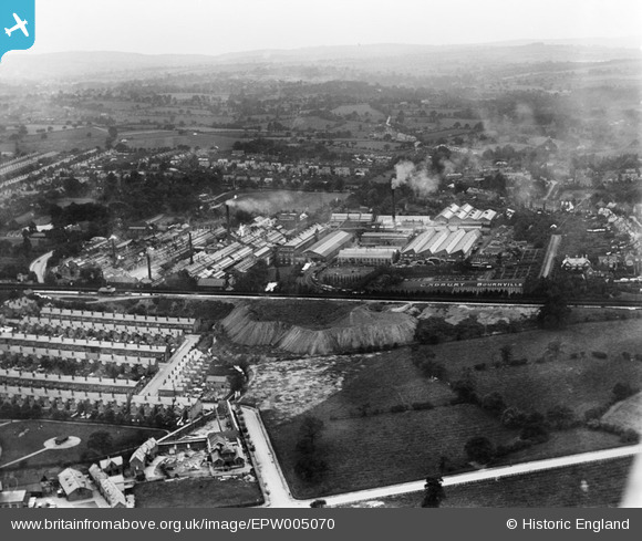
EPW005070 ENGLAND (1920). The Bournville Works, Bournville, from the north-east, 1920
© Copyright OpenStreetMap contributors and licensed by the OpenStreetMap Foundation. 2024. Cartography is licensed as CC BY-SA.
Nearby Images (6)
EPW005070

EPW001239

EPW005073

EPW022578

EPW022579

EPW005072

Details
| Title | [EPW005070] The Bournville Works, Bournville, from the north-east, 1920 |
| Reference | EPW005070 |
| Date | September-1920 |
| Link | |
| Place name | BOURNVILLE |
| Parish | |
| District | |
| Country | ENGLAND |
| Easting / Northing | 405149, 281443 |
| Longitude / Latitude | -1.9242609375167, 52.430567866602 |
| National Grid Reference | SP051814 |
Pins
 John Smith |
Saturday 16th of March 2013 11:55:04 PM | |
John Smith |
Saturday 16th of March 2013 11:53:52 PM | |
John Smith |
Saturday 16th of March 2013 11:52:34 PM | |
John Smith |
Saturday 16th of March 2013 11:51:13 PM | |
John Smith |
Saturday 16th of March 2013 11:47:56 PM |


