
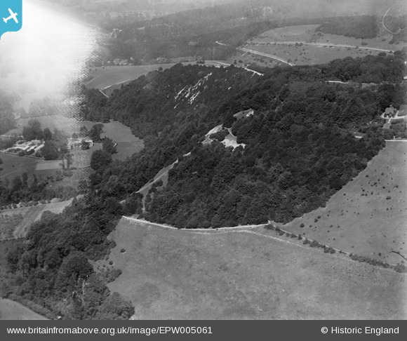
EPW005061 ENGLAND (1920). Box Hill, Westhumble, 1920
© Copyright OpenStreetMap contributors and licensed by the OpenStreetMap Foundation. 2024. Cartography is licensed as CC BY-SA.
Nearby Images (7)
EPW005061

EPW001624

EAW003358

EAW008252

EPW001623

EAW008253

EAW003356

Details
| Title | [EPW005061] Box Hill, Westhumble, 1920 |
| Reference | EPW005061 |
| Date | July-1920 |
| Link | |
| Place name | WESTHUMBLE |
| Parish | BROCKHAM |
| District | |
| Country | ENGLAND |
| Easting / Northing | 517561, 151244 |
| Longitude / Latitude | -0.31541732530651, 51.247723552001 |
| National Grid Reference | TQ176512 |
Pins
 Class31 |
Monday 11th of November 2013 05:12:57 PM |
User Comment Contributions
Westhumble invisible behind cockpit flare, image looking north and slightly west from swiss cottage |
 John |
Monday 25th of June 2012 09:06:38 PM |


