
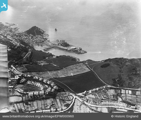
EPW000960 ENGLAND (1920). Hillsborough Fort, Ilfracombe Harbour and Capstone Point, from Chambercombe near Ilfracombe, 1920
© Copyright OpenStreetMap contributors and licensed by the OpenStreetMap Foundation. 2024. Cartography is licensed as CC BY-SA.
Nearby Images (6)
EPW000960

EPW032983

EPW000959

EPW000970

EPW032988

EPW000971

Details
| Title | [EPW000960] Hillsborough Fort, Ilfracombe Harbour and Capstone Point, from Chambercombe near Ilfracombe, 1920 |
| Reference | EPW000960 |
| Date | May-1920 |
| Link | |
| Place name | CHAMBERCOMBE |
| Parish | ILFRACOMBE |
| District | |
| Country | ENGLAND |
| Easting / Northing | 252713, 147751 |
| Longitude / Latitude | -4.1088251452291, 51.209430224265 |
| National Grid Reference | SS527478 |
Pins
 mannidaze |
Friday 25th of January 2019 02:35:31 PM |


