
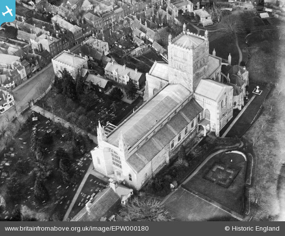
EPW000180 ENGLAND (1920). St Mary's Abbey Church, Tewkesbury, 1920
© Copyright OpenStreetMap contributors and licensed by the OpenStreetMap Foundation. 2024. Cartography is licensed as CC BY-SA.
Nearby Images (14)
EPW000180

EPW023937

EPW023940

EPW023946

EPW000182

EPW000181

EPW023934

EAW006888

EAW049071

EPW023944

EPW023938

EAW006887

EAW049069

EPW023945

Details
| Title | [EPW000180] St Mary's Abbey Church, Tewkesbury, 1920 |
| Reference | EPW000180 |
| Date | February-1920 |
| Link | |
| Place name | TEWKESBURY |
| Parish | TEWKESBURY |
| District | |
| Country | ENGLAND |
| Easting / Northing | 389052, 232440 |
| Longitude / Latitude | -2.1594537481272, 51.989877680429 |
| National Grid Reference | SO891324 |
Pins
 Class31 |
Friday 13th of May 2016 11:07:36 PM |

User Comment Contributions
 St Mary's Abbey Church, Tewkesbury, 09/08/2014 |
Class31 |
Sunday 10th of August 2014 08:44:51 PM |


