
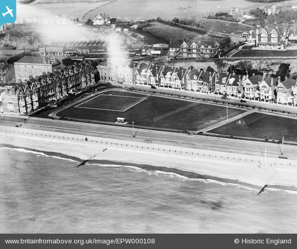
EPW000108 ENGLAND (1920). West Marina Gardens, St Leonards, 1920
© Copyright OpenStreetMap contributors and licensed by the OpenStreetMap Foundation. 2024. Cartography is licensed as CC BY-SA.
Nearby Images (13)
EPW000108

EPW026206

EAW002424

EPW035333

EPW026198

EPW016889

EAW002423

EPW000113

EPW042835

EAW002425

EPW042842

EPW026197

EPW042843

Details
| Title | [EPW000108] West Marina Gardens, St Leonards, 1920 |
| Reference | EPW000108 |
| Date | February-1920 |
| Link | |
| Place name | ST LEONARDS |
| Parish | |
| District | |
| Country | ENGLAND |
| Easting / Northing | 578944, 108760 |
| Longitude / Latitude | 0.54239352226175, 50.850081977949 |
| National Grid Reference | TQ789088 |
Pins
Be the first to add a comment to this image!


