
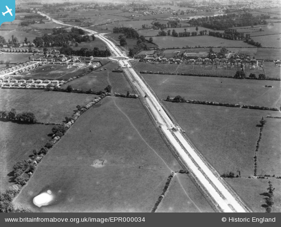
EPR000034 ENGLAND (1934). Western Avenue under construction, Northolt, 1934. This image has been produced from a damaged negative.
© Copyright OpenStreetMap contributors and licensed by the OpenStreetMap Foundation. 2024. Cartography is licensed as CC BY-SA.
Nearby Images (2)
EPR000034

EPW044923

Details
| Title | [EPR000034] Western Avenue under construction, Northolt, 1934. This image has been produced from a damaged negative. |
| Reference | EPR000034 |
| Date | 30-May-1934 |
| Link | |
| Place name | NORTHOLT |
| Parish | |
| District | |
| Country | ENGLAND |
| Easting / Northing | 512136, 184177 |
| Longitude / Latitude | -0.38271249501763, 51.544854363035 |
| National Grid Reference | TQ121842 |
Pins
 The Laird |
Tuesday 10th of May 2016 01:23:50 AM | |
The Laird |
Saturday 4th of April 2015 01:12:32 PM |


