
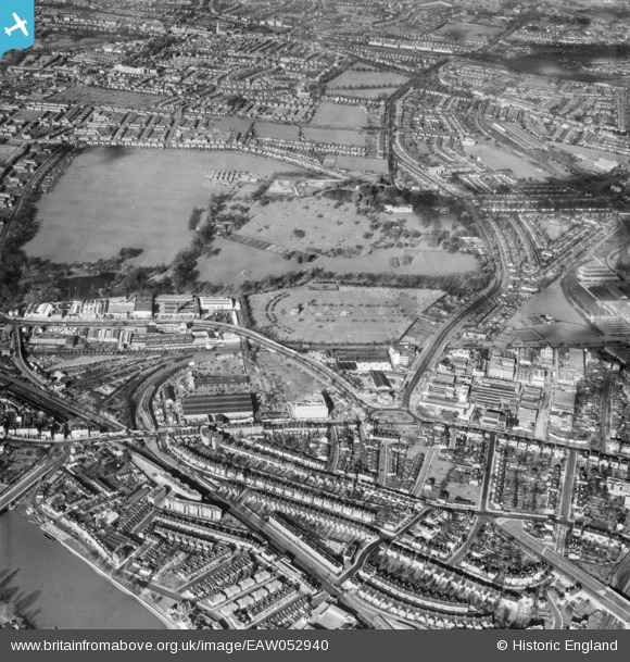
EAW052940 ENGLAND (1953). Kensington Cemetery, Gunnersbury Park and the surrounding area, Brentford, 1953
© Copyright OpenStreetMap contributors and licensed by the OpenStreetMap Foundation. 2024. Cartography is licensed as CC BY-SA.
Nearby Images (21)
EAW052940

EAW052909

EAW052898

EAW052901

EAW052908

EAW052936

EAW052903

EAW052935

EAW052939

EAW052943

EAW052942

EAW052937

EAW052900

EAW052899

EAW052938

EAW052902

EAW052944

EAW052906

EAW052905

EAW052910

EAW052941

Details
| Title | [EAW052940] Kensington Cemetery, Gunnersbury Park and the surrounding area, Brentford, 1953 |
| Reference | EAW052940 |
| Date | 3-November-1953 |
| Link | |
| Place name | BRENTFORD |
| Parish | |
| District | |
| Country | ENGLAND |
| Easting / Northing | 519101, 178639 |
| Longitude / Latitude | -0.28417857940036, 51.493649179905 |
| National Grid Reference | TQ191786 |
Pins
 Leslie B |
Thursday 22nd of December 2022 04:43:00 PM | |
Leslie B |
Thursday 22nd of December 2022 04:41:48 PM | |
Leslie B |
Thursday 22nd of December 2022 04:41:06 PM | |
redmist |
Wednesday 24th of November 2021 10:30:58 PM | |
Isleworth1961 |
Wednesday 5th of August 2020 04:03:14 PM |


