
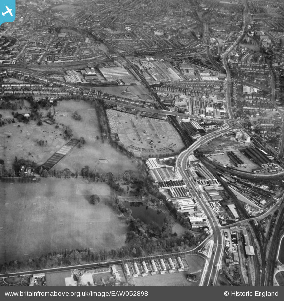
EAW052898 ENGLAND (1953). The Potomac, Kensington Cemetery and the surrounding industrial area, Brentford, 1953
© Copyright OpenStreetMap contributors and licensed by the OpenStreetMap Foundation. 2024. Cartography is licensed as CC BY-SA.
Nearby Images (21)
EAW052898

EAW052939

EAW052909

EAW052942

EAW052940

EAW052937

EAW052936

EAW052899

EAW052901

EAW052943

EAW052903

EAW052908

EAW052935

EAW052900

EAW052938

EAW052944

EAW052902

EAW052941

EAW052910

EAW052905

EPW037583

Details
| Title | [EAW052898] The Potomac, Kensington Cemetery and the surrounding industrial area, Brentford, 1953 |
| Reference | EAW052898 |
| Date | 3-November-1953 |
| Link | |
| Place name | BRENTFORD |
| Parish | |
| District | |
| Country | ENGLAND |
| Easting / Northing | 519053, 178652 |
| Longitude / Latitude | -0.28486536888571, 51.493776141936 |
| National Grid Reference | TQ191787 |
Pins
 Des Elmes |
Wednesday 6th of April 2016 05:11:53 PM | |
Des Elmes |
Wednesday 6th of April 2016 05:08:55 PM | |
Des Elmes |
Wednesday 6th of April 2016 05:04:38 PM | |
Des Elmes |
Wednesday 6th of April 2016 04:55:19 PM | |
Des Elmes |
Wednesday 6th of April 2016 04:53:16 PM | |
Des Elmes |
Wednesday 6th of April 2016 04:51:44 PM | |
Des Elmes |
Wednesday 6th of April 2016 04:19:43 PM |


