
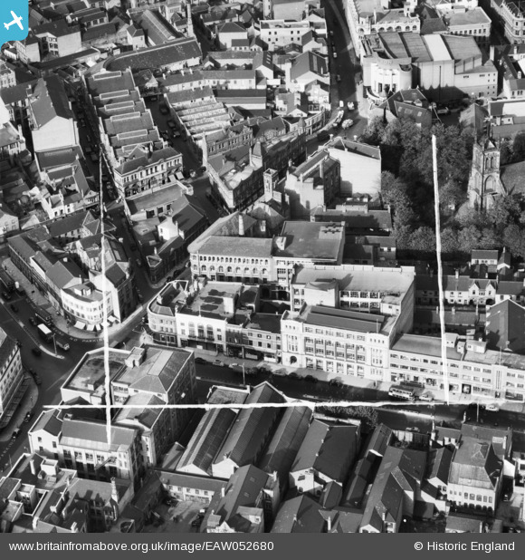
EAW052680 ENGLAND (1953). Arthur Foister and Sons Ltd (Cherub Ltd) Factory on Charles Street, Leicester, 1953. This image was marked by Aerofilms Ltd for photo editing.
© Copyright OpenStreetMap contributors and licensed by the OpenStreetMap Foundation. 2024. Cartography is licensed as CC BY-SA.
Nearby Images (31)
EAW052680
 Factory on Charles Street, Leicester, 1953. This image was marked by Aerofilms Ltd for photo editing.")
EAW052674
 Factory on Charles Street, St George's Church and Rutland Street, Leicester, 1953. This image was marked by Aerofilms Ltd for photo editing.")
EAW052676
 Factory on Charles Street and St George's Church, Leicester, 1953. This image was marked by Aerofilms Ltd for photo editing.")
EAW052675
 Factory on Charles Street, Leicester, 1953. This image was marked by Aerofilms Ltd for photo editing.")
EAW052679
 Factory on Charles Street, Leicester, 1953. This image was marked by Aerofilms Ltd for photo editing.")
EAW052681
 Factory on Charles Street and St George's Church, Leicester, 1953. This image was marked by Aerofilms Ltd for photo editing.")
EPW055009

EAW052678
 Factory on Charles Street, Leicester, 1953. This image was marked by Aerofilms Ltd for photo editing.")
EAW052677

EPW055002

EPW018459

EPW055011

EPW061213

EAW024240

EPW018428

EPW047868

EPW018431

EPW018436

EPW020892

EPW018412

EPW018422

EAW024244

EAW024239

EAW052689
 Factory on Campbell Street and London Road Railway Station, Leicester, 1953. This image was marked by Aerofilms Ltd for photo editing.")
EAW052685
 Factory on Campbell Street and London Road Railway Station, Leicester, 1953. This image was marked by Aerofilms Ltd for photo editing.")
EAW052686
 Factory on Campbell Street and London Road Railway Station, Leicester, 1953. This image was marked by Aerofilms Ltd for photo editing.")
EAW052688
 Factory on Campbell Street and London Road Railway Station, Leicester, 1953. This image was marked by Aerofilms Ltd for photo editing.")
EAW052687
 Factory on Campbell Street and London Road Railway Station, Leicester, 1953. This image was marked by Aerofilms Ltd for photo editing.")
EAW052684
 Factory on Campbell Street, Leicester, 1953. This image was marked by Aerofilms Ltd for photo editing.")
EAW052683
 Factory on Campbell Street and London Road Railway Station, Leicester, 1953. This image was marked by Aerofilms Ltd for photo editing.")
EAW052682
 Factory on Campbell Street and London Road Railway Station, Leicester, 1953. This image was marked by Aerofilms Ltd for photo editing.")
Details
| Title | [EAW052680] Arthur Foister and Sons Ltd (Cherub Ltd) Factory on Charles Street, Leicester, 1953. This image was marked by Aerofilms Ltd for photo editing. |
| Reference | EAW052680 |
| Date | 1-October-1953 |
| Link | |
| Place name | LEICESTER |
| Parish | |
| District | |
| Country | ENGLAND |
| Easting / Northing | 459088, 304415 |
| Longitude / Latitude | -1.1268139717373, 52.6339142366 |
| National Grid Reference | SK591044 |
Pins
Be the first to add a comment to this image!


