
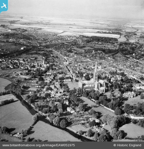
EAW051975 ENGLAND (1953). St Mary's Cathedral and the city, Salisbury, from the south, 1953
© Copyright OpenStreetMap contributors and licensed by the OpenStreetMap Foundation. 2024. Cartography is licensed as CC BY-SA.
Nearby Images (24)
EAW051975

EAW003562

EAW051974

EAW051976

EAW025829
, Salisbury, 1949. This image has been produced from a damaged negative.")
EAW003564

EAW051987

EAW051967

EPW041083

EPW041084

EAW051969

EAW025831

EAW025826

EAW051986

EAW025828
, Salisbury, 1949. This image has been produced from a damaged negative.")
EAW025832

EAW051988

EAW051978

EAW003563

EAW025827

EAW051977

EPW011038

EPW041080

EPW011037

Details
| Title | [EAW051975] St Mary's Cathedral and the city, Salisbury, from the south, 1953 |
| Reference | EAW051975 |
| Date | 5-September-1953 |
| Link | |
| Place name | SALISBURY |
| Parish | SALISBURY |
| District | |
| Country | ENGLAND |
| Easting / Northing | 414168, 129445 |
| Longitude / Latitude | -1.7977930386907, 51.063631667433 |
| National Grid Reference | SU142294 |
Pins
 Lee |
Tuesday 14th of March 2017 04:46:49 AM | |
Lee |
Tuesday 14th of March 2017 04:45:23 AM | |
Lee |
Tuesday 14th of March 2017 04:44:28 AM | |
Lee |
Tuesday 14th of March 2017 04:43:41 AM | |
Lee |
Tuesday 14th of March 2017 04:42:41 AM | |
Lee |
Tuesday 14th of March 2017 04:41:10 AM | |
 HectorDavie |
Tuesday 18th of November 2014 12:32:02 PM | |
HectorDavie |
Tuesday 18th of November 2014 12:31:08 PM | |
HectorDavie |
Tuesday 18th of November 2014 12:30:08 PM | |
HectorDavie |
Tuesday 18th of November 2014 12:27:08 PM | |
HectorDavie |
Tuesday 18th of November 2014 12:25:13 PM | |
HectorDavie |
Tuesday 18th of November 2014 12:24:38 PM | |
HectorDavie |
Tuesday 18th of November 2014 12:23:44 PM | |
HectorDavie |
Tuesday 18th of November 2014 12:22:24 PM | |
HectorDavie |
Tuesday 18th of November 2014 12:19:02 PM |


