
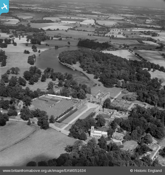
EAW051634 ENGLAND (1953). Blickling Hall and Park, Blickling, from the south, 1953
© Copyright OpenStreetMap contributors and licensed by the OpenStreetMap Foundation. 2024. Cartography is licensed as CC BY-SA.
Nearby Images (17)
EAW051634

EAW018540

EAW018542

EPW039264

EAW051629

EPW039266

EPW021296A

EAW018541

EAW051632

EAW051631

EAW051630

EAW051635

EPW039265

EPW039268

EAW018543

EPW039267

EAW051633

Details
| Title | [EAW051634] Blickling Hall and Park, Blickling, from the south, 1953 |
| Reference | EAW051634 |
| Date | 26-August-1953 |
| Link | |
| Place name | BLICKLING |
| Parish | BLICKLING |
| District | |
| Country | ENGLAND |
| Easting / Northing | 617848, 328541 |
| Longitude / Latitude | 1.2327176582554, 52.810002645279 |
| National Grid Reference | TG178285 |
Pins
 Matt Aldred edob.mattaldred.com |
Monday 1st of July 2019 02:18:15 PM | |
Matt Aldred edob.mattaldred.com |
Monday 1st of July 2019 02:18:07 PM |


