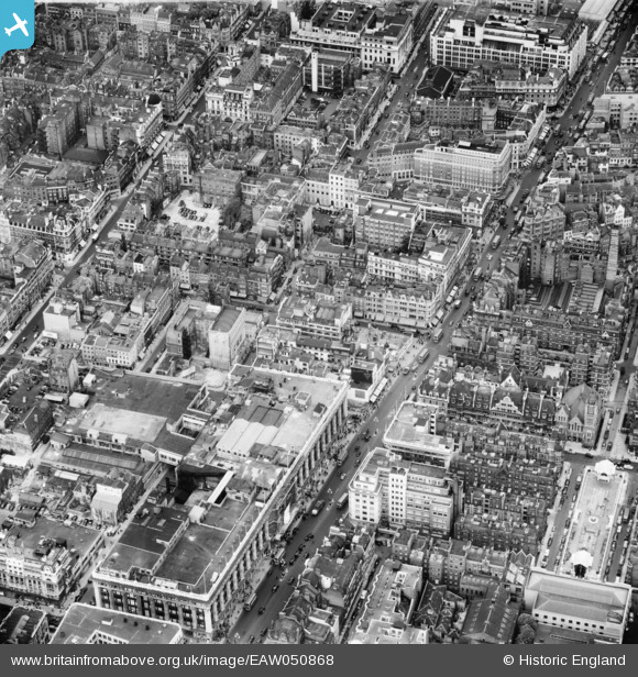
EAW050868 ENGLAND (1953). Oxford Street including Selfridges Department Store, Westminster, 1953
© Copyright OpenStreetMap contributors and licensed by the OpenStreetMap Foundation. 2024. Cartography is licensed as CC BY-SA.
Nearby Images (28)
EAW050868

EAW050854

EAW050850

EAW052483

EAW000563

EPW060765

EPW047237

EPW046656

EAW052484

EAW050871

EPW021967

EAW021412

EPW046655

EPW059412

EAW021411

EAW050839

EPW021443

EPW006306

EAW021408

EAW021409

EPW021935

EPW045399

EAW021410

EPW021936

EPW060755

EPW006304

EAW050867

EPW045400

Details
| Title | [EAW050868] Oxford Street including Selfridges Department Store, Westminster, 1953 |
| Reference | EAW050868 |
| Date | 23-July-1953 |
| Link | |
| Place name | WESTMINSTER |
| Parish | |
| District | |
| Country | ENGLAND |
| Easting / Northing | 528411, 181152 |
| Longitude / Latitude | -0.14921205147559, 51.514197315937 |
| National Grid Reference | TQ284812 |
Pins
 Alan McFaden |
Thursday 11th of September 2014 09:17:31 AM | |
Alan McFaden |
Thursday 11th of September 2014 09:17:08 AM |