
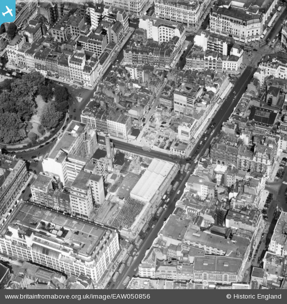
EAW050856 ENGLAND (1953). Oxford Street and Hollies Street including John Lewis Department Store, Westminster, 1953
© Copyright OpenStreetMap contributors and licensed by the OpenStreetMap Foundation. 2024. Cartography is licensed as CC BY-SA.
Nearby Images (36)
EAW050856

EAW000559

EAW050836

EAW052486

EAW050838

EAW052487

EPW021934

EAW052488

EPW021404

EPW045398

EAW050840

EAW050853

EAW050859

EAW000560

EPW017689

EAW050865

EPW055355

EAW050861

EAW050866

EAW050869

EAW052485

EPW021945

EAW030115

EPW006000

EPW038463

EPW060758

EPW044587

EAW050843

EPW012747

EAW041946

EPW046654

EPW006304

EPW053003

EPW021885

EPW044588

EPW021947

Details
| Title | [EAW050856] Oxford Street and Hollies Street including John Lewis Department Store, Westminster, 1953 |
| Reference | EAW050856 |
| Date | 23-July-1953 |
| Link | |
| Place name | WESTMINSTER |
| Parish | |
| District | |
| Country | ENGLAND |
| Easting / Northing | 528850, 181244 |
| Longitude / Latitude | -0.14285467717636, 51.51492421863 |
| National Grid Reference | TQ289812 |
Pins
 Alan McFaden |
Saturday 8th of November 2014 03:18:47 PM | |
Alan McFaden |
Saturday 8th of November 2014 03:17:29 PM |


User Comment Contributions
 John Lewis Dept Store Oxford Street |
Alan McFaden |
Friday 12th of September 2014 10:39:03 AM |


