
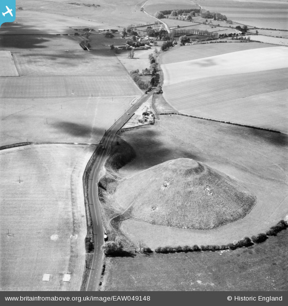
EAW049148 ENGLAND (1953). Silbury Hill, Avebury, 1953
© Copyright OpenStreetMap contributors and licensed by the OpenStreetMap Foundation. 2024. Cartography is licensed as CC BY-SA.
Nearby Images (13)
EAW049148

EAW034894

EAW034896

EAW007043

EAW034895

EAW007045

EAW034893

EAW034892

EAW002275

EAW049149

EAW007044

EAW034891

EAW049150

Details
| Title | [EAW049148] Silbury Hill, Avebury, 1953 |
| Reference | EAW049148 |
| Date | 5-May-1953 |
| Link | |
| Place name | AVEBURY |
| Parish | AVEBURY |
| District | |
| Country | ENGLAND |
| Easting / Northing | 409871, 168531 |
| Longitude / Latitude | -1.8580422320491, 51.415217386856 |
| National Grid Reference | SU099685 |
Pins

User Comment Contributions
 Silbury Hill 28/12/2007 |
 Class31 |
Tuesday 9th of December 2014 03:46:11 PM |


