
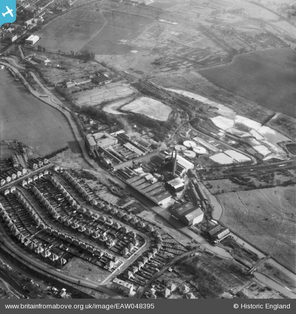
EAW048395 ENGLAND (1953). Croxley Paper Mills and the Grand Union Canal, Croxley Green, 1953
© Copyright OpenStreetMap contributors and licensed by the OpenStreetMap Foundation. 2024. Cartography is licensed as CC BY-SA.
Nearby Images (21)
EAW048395

EPW015998

EPW039591

EPW039596

EPW015996

EPW039595

EPW015995

EAW048396

EAW048391

EAW048397

EAW048393

EPW019274

EPW019275

EPW039592

EAW048394

EPW015997

EPW039590

EPW039597

EPW039593

EPW039594

EAW048392

Details
| Title | [EAW048395] Croxley Paper Mills and the Grand Union Canal, Croxley Green, 1953 |
| Reference | EAW048395 |
| Date | 5-February-1953 |
| Link | |
| Place name | CROXLEY GREEN |
| Parish | CROXLEY GREEN |
| District | |
| Country | ENGLAND |
| Easting / Northing | 508460, 195368 |
| Longitude / Latitude | -0.43224777374151, 51.646168865645 |
| National Grid Reference | TQ085954 |
Pins
Be the first to add a comment to this image!


