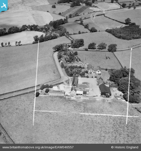
EAW046557 ENGLAND (1952). Hound Hill, Worsbrough, 1952. This image was marked by Aerofilms Ltd for photo editing.
© Copyright OpenStreetMap contributors and licensed by the OpenStreetMap Foundation. 2024. Cartography is licensed as CC BY-SA.
Nearby Images (8)
Details
| Title | [EAW046557] Hound Hill, Worsbrough, 1952. This image was marked by Aerofilms Ltd for photo editing. |
| Reference | EAW046557 |
| Date | 1-September-1952 |
| Link | |
| Place name | WORSBROUGH |
| Parish | |
| District | |
| Country | ENGLAND |
| Easting / Northing | 433693, 404119 |
| Longitude / Latitude | -1.4916204472683, 53.53239885657 |
| National Grid Reference | SE337041 |
Pins
Be the first to add a comment to this image!


![[EAW046557] Hound Hill, Worsbrough, 1952. This image was marked by Aerofilms Ltd for photo editing.](http://britainfromabove.org.uk/sites/all/libraries/aerofilms-images/public/100x100/EAW/046/EAW046557.jpg)
![[EAW046559] Hound Hill, Worsbrough, 1952. This image was marked by Aerofilms Ltd for photo editing.](http://britainfromabove.org.uk/sites/all/libraries/aerofilms-images/public/100x100/EAW/046/EAW046559.jpg)
![[EAW046556] Hound Hill, Worsbrough, 1952. This image was marked by Aerofilms Ltd for photo editing.](http://britainfromabove.org.uk/sites/all/libraries/aerofilms-images/public/100x100/EAW/046/EAW046556.jpg)
![[EAW046555] Hound Hill, Worsbrough, 1952. This image was marked by Aerofilms Ltd for photo editing.](http://britainfromabove.org.uk/sites/all/libraries/aerofilms-images/public/100x100/EAW/046/EAW046555.jpg)
![[EAW046558] Hound Hill, Worsbrough, 1952. This image was marked by Aerofilms Ltd for photo editing.](http://britainfromabove.org.uk/sites/all/libraries/aerofilms-images/public/100x100/EAW/046/EAW046558.jpg)
![[EAW025620] Billingley, Open Cast Coal Quarry south of the village, 1949. This image has been produced from a print.](http://britainfromabove.org.uk/sites/all/libraries/aerofilms-images/public/100x100/EAW/025/EAW025620.jpg)
![[EAW025621] Billingley, Open Cast Coal Quarry south of the village, 1949. This image has been produced from a print.](http://britainfromabove.org.uk/sites/all/libraries/aerofilms-images/public/100x100/EAW/025/EAW025621.jpg)
![[EAW025616] Billingley, Open Cast Coal Quarry south of the village, 1949. This image has been produced from a print.](http://britainfromabove.org.uk/sites/all/libraries/aerofilms-images/public/100x100/EAW/025/EAW025616.jpg)


