
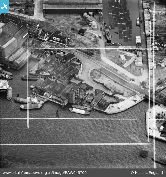
EAW045700 ENGLAND (1952). Dinorwic Wharf and Surrey Commercial Wharf, Surrey Docks, 1952. This image was marked by Aerofilms Ltd for photo editing.
© Copyright OpenStreetMap contributors and licensed by the OpenStreetMap Foundation. 2024. Cartography is licensed as CC BY-SA.
Nearby Images (14)
EAW045700

EAW045704

EAW045703

EAW045698

EAW045701

EAW045702

EAW045699

EPW009339

EPW009340

EPW009114

EPW009338

EPW009099

EPW060799

EAW025480

Details
| Title | [EAW045700] Dinorwic Wharf and Surrey Commercial Wharf, Surrey Docks, 1952. This image was marked by Aerofilms Ltd for photo editing. |
| Reference | EAW045700 |
| Date | 5-August-1952 |
| Link | |
| Place name | SURREY DOCKS |
| Parish | |
| District | |
| Country | ENGLAND |
| Easting / Northing | 535628, 180241 |
| Longitude / Latitude | -0.045607269467011, 51.504323198804 |
| National Grid Reference | TQ356802 |
Pins
 billybuttons |
Monday 24th of April 2017 09:42:30 PM | |
billybuttons |
Monday 24th of April 2017 09:41:50 PM | |
billybuttons |
Monday 24th of April 2017 09:39:45 PM |
User Comment Contributions
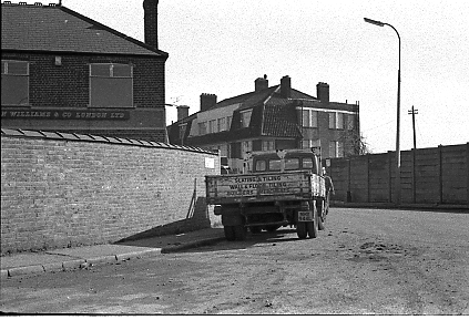 Photo taken in 1977 showing Surrey House in the background |
billybuttons |
Monday 24th of April 2017 10:56:13 PM |


