
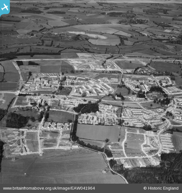
EAW041964 ENGLAND (1952). Development of the Mark Hall neighbourhood, Mark Hall North, 1952
© Copyright OpenStreetMap contributors and licensed by the OpenStreetMap Foundation. 2024. Cartography is licensed as CC BY-SA.
Nearby Images (5)
EAW041964

EAW041965

EAW041969

EAW041966

EAW041963

Details
| Title | [EAW041964] Development of the Mark Hall neighbourhood, Mark Hall North, 1952 |
| Reference | EAW041964 |
| Date | 14-March-1952 |
| Link | |
| Place name | MARK HALL NORTH |
| Parish | |
| District | |
| Country | ENGLAND |
| Easting / Northing | 546223, 210938 |
| Longitude / Latitude | 0.11978743334186, 51.777529431984 |
| National Grid Reference | TL462109 |
Pins
 clare600 |
Saturday 22nd of November 2014 10:44:52 AM | |
clare600 |
Saturday 22nd of November 2014 10:29:37 AM | |
Mikeya |
Monday 18th of August 2014 07:54:47 PM | |
Mikeya |
Monday 18th of August 2014 07:53:38 PM | |
Mikeya |
Monday 18th of August 2014 07:53:07 PM | |
Mikeya |
Monday 18th of August 2014 07:52:17 PM |


