
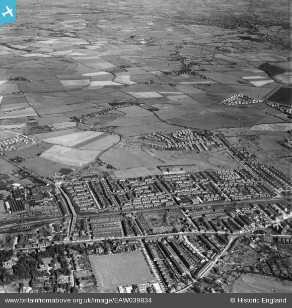
EAW039834 ENGLAND (1951). The Victoria Estate and environs, Whitefield, 1951
© Copyright OpenStreetMap contributors and licensed by the OpenStreetMap Foundation. 2024. Cartography is licensed as CC BY-SA.
Nearby Images (2)
EAW039834

EAW039835

Details
| Title | [EAW039834] The Victoria Estate and environs, Whitefield, 1951 |
| Reference | EAW039834 |
| Date | 15-September-1951 |
| Link | |
| Place name | WHITEFIELD |
| Parish | |
| District | |
| Country | ENGLAND |
| Easting / Northing | 381527, 405738 |
| Longitude / Latitude | -2.2788311819482, 53.547708296698 |
| National Grid Reference | SD815057 |
Pins
 Paul Williams |
Wednesday 13th of September 2023 09:13:12 PM | |
Paul Williams |
Wednesday 13th of September 2023 09:12:33 PM | |
Paul Williams |
Wednesday 13th of September 2023 09:10:39 PM | |
English Lady |
Friday 18th of November 2022 10:00:00 PM | |
English Lady |
Friday 18th of November 2022 09:54:36 PM | |
redmist |
Friday 28th of December 2018 08:32:08 PM | |
boltie |
Wednesday 17th of May 2017 01:38:06 AM | |
boltie |
Wednesday 12th of April 2017 06:02:34 PM | |
boltie |
Wednesday 12th of April 2017 06:02:34 PM | |
boltie |
Friday 2nd of January 2015 12:34:11 AM |


