
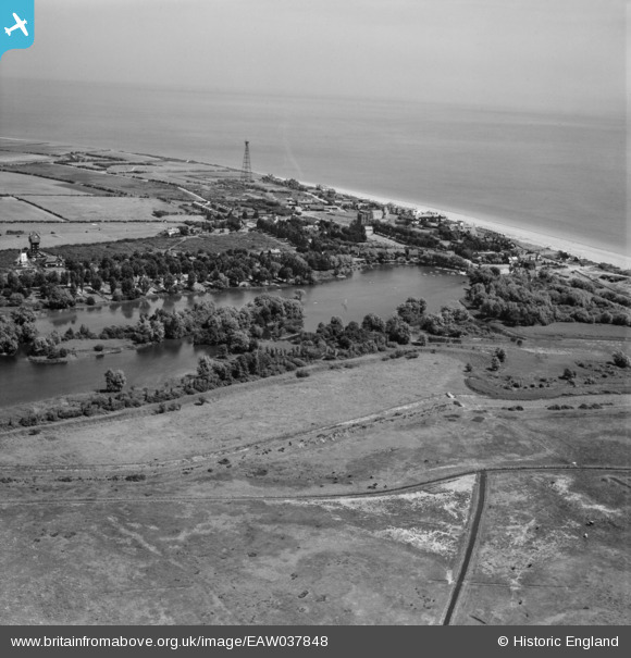
EAW037848 ENGLAND (1951). The Meare and the village, Thorpeness, from the south-west, 1951
© Copyright OpenStreetMap contributors and licensed by the OpenStreetMap Foundation. 2024. Cartography is licensed as CC BY-SA.
Nearby Images (2)
EAW037848

EPW001910

Details
| Title | [EAW037848] The Meare and the village, Thorpeness, from the south-west, 1951 |
| Reference | EAW037848 |
| Date | 17-July-1951 |
| Link | |
| Place name | THORPENESS |
| Parish | ALDRINGHAM CUM THORPE |
| District | |
| Country | ENGLAND |
| Easting / Northing | 646733, 259413 |
| Longitude / Latitude | 1.6092524172914, 52.17728818488 |
| National Grid Reference | TM467594 |
Pins
 Matt Aldred edob.mattaldred.com |
Monday 17th of October 2022 01:25:22 PM | |
Matt Aldred edob.mattaldred.com |
Monday 17th of October 2022 01:23:25 PM | |
 Dennis Jackson |
Monday 22nd of September 2014 04:09:32 AM | |
Dennis Jackson |
Monday 22nd of September 2014 04:08:09 AM | |
ChrisJones |
Thursday 24th of July 2014 08:04:59 PM | |
GlenDenny53 |
Monday 9th of June 2014 04:11:19 PM | |
cptpies |
Thursday 8th of May 2014 11:51:35 AM | |
cptpies |
Thursday 8th of May 2014 11:50:25 AM | |
cptpies |
Thursday 8th of May 2014 11:50:03 AM | |
cptpies |
Thursday 8th of May 2014 11:48:53 AM |


