
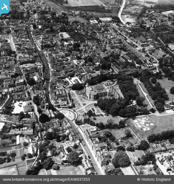
EAW037253 ENGLAND (1951). The Castle Museum, High Street and town centre, Colchester, 1951. This image has been produced from a print.
© Copyright OpenStreetMap contributors and licensed by the OpenStreetMap Foundation. 2024. Cartography is licensed as CC BY-SA.
Nearby Images (39)
EAW037253

EAW008093

EAW008091

EAW008094

EAW014005

EAW014007

EAW014004

EAW014009

EAW014006

EAW008095

EAW029734

EAW014003

EAW008092

EAW013999

EAW037254

EAW014008

EAW037491

EPW018558

EAW029729

EPW018549

EAW014002

EPW016543

EPW016543
EPW018550

EAW014010

EPW058740

EAW015360

EAW037495

EAW037499

EAW056122

EAW029730

EPW018546

EAW024677

EPW058742

EAW037497

EAW037498

EPW018559

EAW037258

EAW037255

Details
| Title | [EAW037253] The Castle Museum, High Street and town centre, Colchester, 1951. This image has been produced from a print. |
| Reference | EAW037253 |
| Date | 21-June-1951 |
| Link | |
| Place name | COLCHESTER |
| Parish | |
| District | |
| Country | ENGLAND |
| Easting / Northing | 599851, 225299 |
| Longitude / Latitude | 0.9045920352768, 51.889921518465 |
| National Grid Reference | TL999253 |
Pins
Be the first to add a comment to this image!


