
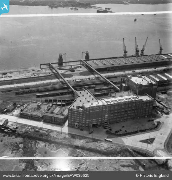
EAW035625 ENGLAND (1951). Joseph Rank Ltd Solent Flour Mills, Southampton, 1951. This image has been produced from a print marked by Aerofilms Ltd for photo editing.
© Copyright OpenStreetMap contributors and licensed by the OpenStreetMap Foundation. 2024. Cartography is licensed as CC BY-SA.
Nearby Images (38)
EAW035625

EAW020012

EAW035622

EAW004217

EAW035620

EAW020019

EAW035623

EAW035619

EAW035615

EAW035621

EAW035618

EAW004214

EAW035617

EAW004215

EAW035616

EAW004220

EAW020013

EAW035624

EAW004218

EAW020018

EAW020021

EAW004221

EAW004216

EPW032349
 under construction, Southampton, from the west, 1930. This image has been produced from a copy-negative.")
EAW020015

EAW004219

EAW020020

EAW004213

EAW020016

EAW020014

EAW001344
, Southampton, from the south, 1946")
EAW004212

EAW001338
, Southampton, 1946")
EAW001363
, Southampton, from the south-west, 1946")
EAW001360
, Southampton, from the north-west, 1946")
EAW001366
, Southampton, 1946")
EAW001356
, Southampton, from the north-west, 1946")
EAW001365
, Southampton, from the south-west, 1946")
Details
| Title | [EAW035625] Joseph Rank Ltd Solent Flour Mills, Southampton, 1951. This image has been produced from a print marked by Aerofilms Ltd for photo editing. |
| Reference | EAW035625 |
| Date | 25-April-1951 |
| Link | |
| Place name | SOUTHAMPTON |
| Parish | |
| District | |
| Country | ENGLAND |
| Easting / Northing | 441015, 111634 |
| Longitude / Latitude | -1.4166553829468, 50.902169556558 |
| National Grid Reference | SU410116 |
Pins
Be the first to add a comment to this image!


