
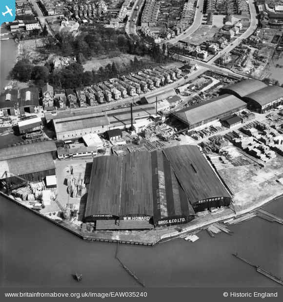
EAW035240 ENGLAND (1951). W. W. Howard Bros & Co Ltd Timber Yard at Timber Wharf, Bitterne, 1951
© Copyright OpenStreetMap contributors and licensed by the OpenStreetMap Foundation. 2024. Cartography is licensed as CC BY-SA.
Nearby Images (14)
EAW035240

EAW035241

EAW035234

EAW035238

EAW035231

EAW035239

EPW041059

EAW035229

EAW035236

EAW035232

EAW035233

EAW035230

EAW035235

EAW035237

Details
| Title | [EAW035240] W. W. Howard Bros & Co Ltd Timber Yard at Timber Wharf, Bitterne, 1951 |
| Reference | EAW035240 |
| Date | 6-April-1951 |
| Link | |
| Place name | BITTERNE |
| Parish | |
| District | |
| Country | ENGLAND |
| Easting / Northing | 443256, 113247 |
| Longitude / Latitude | -1.384592948882, 50.916511506579 |
| National Grid Reference | SU433132 |
Pins
User Comment Contributions
This area is the site of a small Roman town from around the 1st and 2nd centuries, probably called Clausentum. |
 SteveA |
Wednesday 8th of October 2014 09:47:27 AM |


