
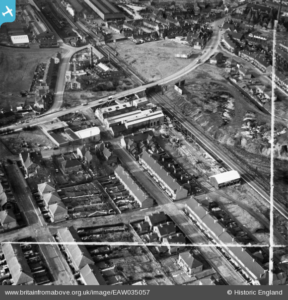
EAW035057 ENGLAND (1951). The Jesshope Ltd Engineering Works, Porthill, 1951. This image was marked by Aerofilms Ltd for photo editing.
© Copyright OpenStreetMap contributors and licensed by the OpenStreetMap Foundation. 2024. Cartography is licensed as CC BY-SA.
Nearby Images (18)
EAW035057

EAW035060

EAW035055

EAW035059

EAW035052

EAW018100

EAW035056

EAW035051

EAW018102

EAW018096

EAW018098

EAW035053

EAW018101

EAW018099

EAW035058

EAW018097

EAW035054

EAW018103

Details
| Title | [EAW035057] The Jesshope Ltd Engineering Works, Porthill, 1951. This image was marked by Aerofilms Ltd for photo editing. |
| Reference | EAW035057 |
| Date | 20-March-1951 |
| Link | |
| Place name | PORTHILL |
| Parish | |
| District | |
| Country | ENGLAND |
| Easting / Northing | 385709, 349169 |
| Longitude / Latitude | -2.2131619616859, 53.039299869828 |
| National Grid Reference | SJ857492 |
Pins
 bescotbeast |
Friday 19th of September 2014 02:07:47 AM |
User Comment Contributions
 Longport Station signal box, McKenzie and Holland Type 1 design |
bescotbeast |
Friday 19th of September 2014 02:08:36 AM |


