
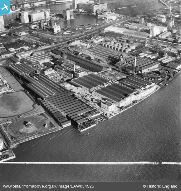
EAW034525 ENGLAND (1951). The Venesta and Crescent Wharves, Silvertown, 1951. This image was marked by Aerofilms Ltd for photo editing.
© Copyright OpenStreetMap contributors and licensed by the OpenStreetMap Foundation. 2024. Cartography is licensed as CC BY-SA.
Nearby Images (23)
EAW034525

EAW034523

EAW034518

EAW034520

EAW034522

EAW034528

EAW034519

EAW034526

EAW034521

EAW034527

EAW034524

EPW009699

EPW009701

EPW009702

EPW009703

EPW009700

EPW009704

EPW006144

EAW021112

EPW024230

EPW024233

EPW024239

EPW009695

Details
| Title | [EAW034525] The Venesta and Crescent Wharves, Silvertown, 1951. This image was marked by Aerofilms Ltd for photo editing. |
| Reference | EAW034525 |
| Date | 5-February-1951 |
| Link | |
| Place name | SILVERTOWN |
| Parish | |
| District | |
| Country | ENGLAND |
| Easting / Northing | 540691, 179769 |
| Longitude / Latitude | 0.027113794906023, 51.498843501388 |
| National Grid Reference | TQ407798 |
Pins
 Class31 |
Saturday 28th of February 2015 08:50:51 AM |


