
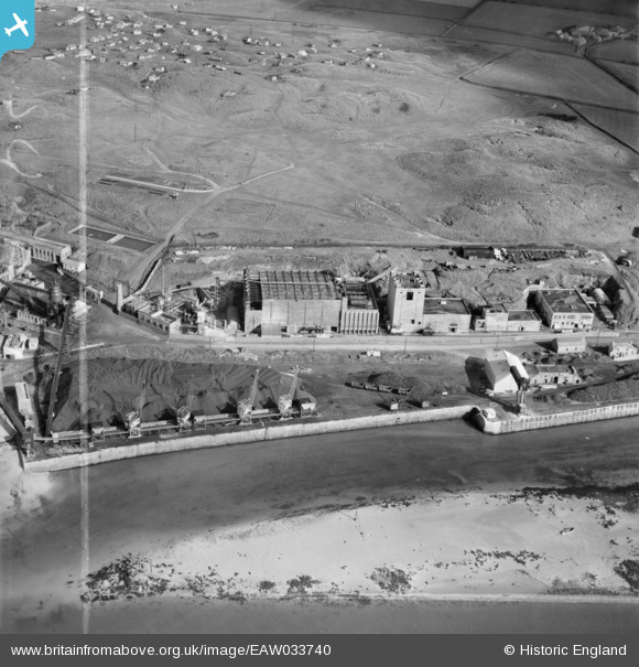
EAW033740 ENGLAND (1950). The Associated Ethyl Co Ltd Works at Hayle Harbour, Hayle, 1950. This image was marked by Aerofilms Ltd for photo editing.
© Copyright OpenStreetMap contributors and licensed by the OpenStreetMap Foundation. 2024. Cartography is licensed as CC BY-SA.
Nearby Images (41)
EAW033740

EAW033736

EAW007758

EAW007761

EAW007757

EAW007753

EAW007751

EAW007756

EAW033738

EAW033737

EAW033741

EAW007759

EAW007752

EAW007755

EAW007754

EAW007760

EAW033739

EAW021308

EAW021306

EAW033733

EAW033732

EPW009868

EPW009865

EAW033735

EAW021314

EPW009864

EAW021316

EPW021742

EAW021310

EAW021307

EPW009866

EPW009867

EAW033734

EAW030943

EAW021313

EAW021311
, Hayle, 1949. This image has been produced from a damaged negative.")
EAW021312

EAW021315

EAW033730

EAW033731

EAW021309
, Hayle, 1949. This image has been produced from a damaged negative.")
Details
| Title | [EAW033740] The Associated Ethyl Co Ltd Works at Hayle Harbour, Hayle, 1950. This image was marked by Aerofilms Ltd for photo editing. |
| Reference | EAW033740 |
| Date | 16-October-1950 |
| Link | |
| Place name | HAYLE |
| Parish | HAYLE |
| District | |
| Country | ENGLAND |
| Easting / Northing | 155445, 37921 |
| Longitude / Latitude | -5.4265986199429, 50.19010225841 |
| National Grid Reference | SW554379 |
Pins
 redmist |
Wednesday 15th of July 2020 04:10:18 PM | |
redmist |
Wednesday 15th of July 2020 04:09:48 PM | |
redmist |
Wednesday 15th of July 2020 04:09:27 PM |


