
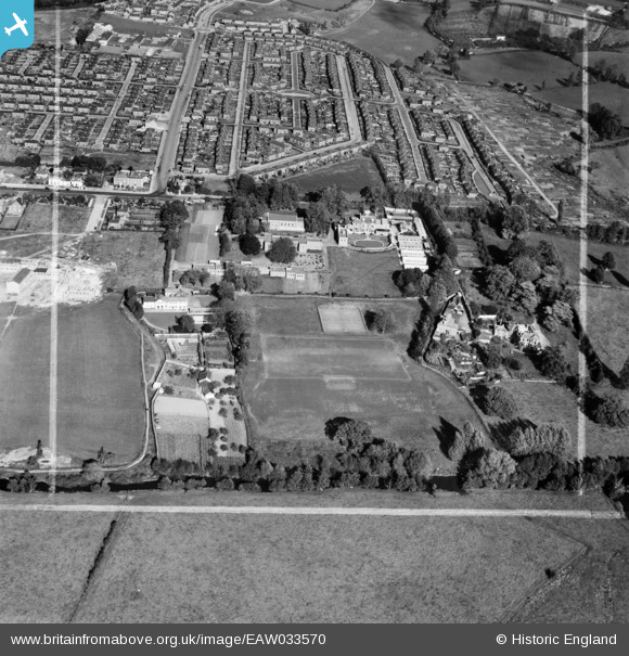
EAW033570 ENGLAND (1950). St Loyes College and housing off Burnthouse Lane, Exeter, 1950. This image was marked by Aerofilms Ltd for photo editing.
© Copyright OpenStreetMap contributors and licensed by the OpenStreetMap Foundation. 2024. Cartography is licensed as CC BY-SA.
Nearby Images (10)
EAW033570

EAW033571

EAW033573

EAW033574

EAW033568

EAW033567

EAW033572

EAW033575

EAW033569

EPW041175

Details
| Title | [EAW033570] St Loyes College and housing off Burnthouse Lane, Exeter, 1950. This image was marked by Aerofilms Ltd for photo editing. |
| Reference | EAW033570 |
| Date | 12-October-1950 |
| Link | |
| Place name | EXETER |
| Parish | |
| District | |
| Country | ENGLAND |
| Easting / Northing | 293617, 90725 |
| Longitude / Latitude | -3.5067563513264, 50.705843064236 |
| National Grid Reference | SX936907 |


