
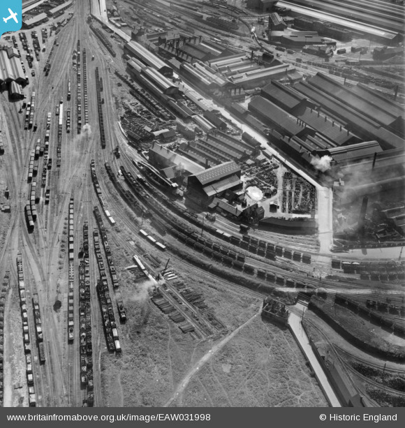
EAW031998 ENGLAND (1950). James and Ronald Ritchie Ltd Acklam Foundry, Middlesbrough, 1950
© Copyright OpenStreetMap contributors and licensed by the OpenStreetMap Foundation. 2024. Cartography is licensed as CC BY-SA.
Nearby Images (8)
EAW031998

EAW032001

EAW031999

EAW031997

EAW031995

EAW031994

EAW031996

EAW032000

Details
| Title | [EAW031998] James and Ronald Ritchie Ltd Acklam Foundry, Middlesbrough, 1950 |
| Reference | EAW031998 |
| Date | 16-August-1950 |
| Link | |
| Place name | MIDDLESBROUGH |
| Parish | |
| District | |
| Country | ENGLAND |
| Easting / Northing | 448978, 521192 |
| Longitude / Latitude | -1.2420928571009, 54.583431489745 |
| National Grid Reference | NZ490212 |
Pins
 redmist |
Monday 29th of November 2021 11:19:42 PM | |
Wayne23 |
Monday 31st of October 2016 06:00:40 PM | |
David Crawford |
Sunday 27th of September 2015 11:34:03 PM |


