
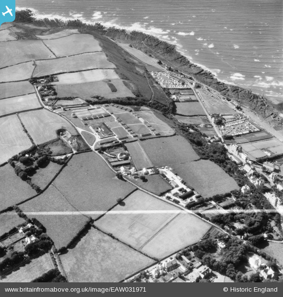
EAW031971 ENGLAND (1950). The Westward Ho! Holiday Centre and Kipling Tors, Westward Ho!, 1950. This image was marked by Aerofilms Ltd for photo editing.
© Copyright OpenStreetMap contributors and licensed by the OpenStreetMap Foundation. 2024. Cartography is licensed as CC BY-SA.
Nearby Images (3)
EAW031971

EAW031970

EAW031969

Details
| Title | [EAW031971] The Westward Ho! Holiday Centre and Kipling Tors, Westward Ho!, 1950. This image was marked by Aerofilms Ltd for photo editing. |
| Reference | EAW031971 |
| Date | 17-August-1950 |
| Link | |
| Place name | WESTWARD HO! |
| Parish | NORTHAM |
| District | |
| Country | ENGLAND |
| Easting / Northing | 242914, 128794 |
| Longitude / Latitude | -4.2407523972044, 51.03646780188 |
| National Grid Reference | SS429288 |


