
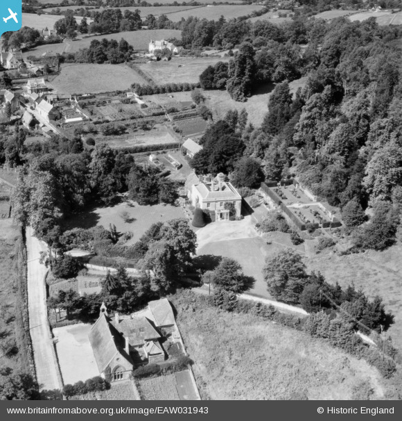
EAW031943 ENGLAND (1950). Knoyle Place, East Knoyle, 1950
© Copyright OpenStreetMap contributors and licensed by the OpenStreetMap Foundation. 2024. Cartography is licensed as CC BY-SA.
Nearby Images (8)
EAW031943

EAW031945

EAW031944

EAW031949

EAW032036

EAW031948

EAW031946

EAW031947

Details
| Title | [EAW031943] Knoyle Place, East Knoyle, 1950 |
| Reference | EAW031943 |
| Date | 17-August-1950 |
| Link | |
| Place name | EAST KNOYLE |
| Parish | EAST KNOYLE |
| District | |
| Country | ENGLAND |
| Easting / Northing | 387861, 130508 |
| Longitude / Latitude | -2.1732847384772, 51.07323786907 |
| National Grid Reference | ST879305 |
Pins
 Class31 |
Thursday 9th of June 2016 07:48:18 AM |
User Comment Contributions
 Knoyle Place, East Knoyle, 02/06/2016 |
Class31 |
Thursday 9th of June 2016 07:49:58 AM |


