
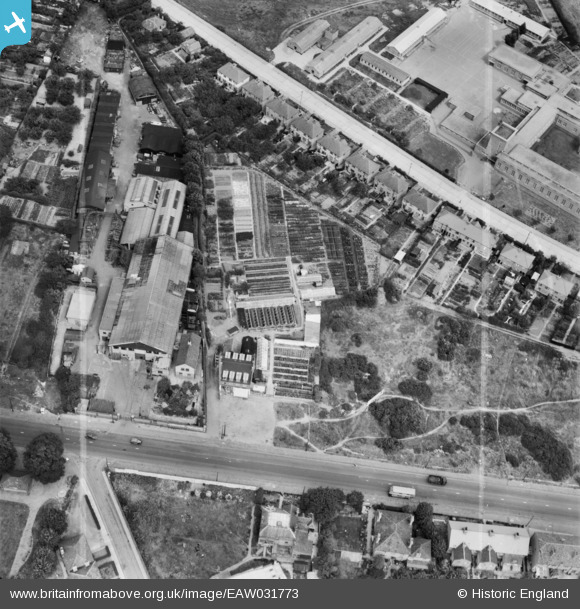
EAW031773 ENGLAND (1950). Knight's Boundary Nursery and Gardens, Hillingdon Heath, 1950. This image was marked by Aerofilms Ltd for photo editing.
© Copyright OpenStreetMap contributors and licensed by the OpenStreetMap Foundation. 2024. Cartography is licensed as CC BY-SA.
Nearby Images (10)
EAW031773

EAW031767

EAW031766

EAW031768

EAW031772

EAW031769

EAW031774

EAW031771

EAW031770

EPW031276

Details
| Title | [EAW031773] Knight's Boundary Nursery and Gardens, Hillingdon Heath, 1950. This image was marked by Aerofilms Ltd for photo editing. |
| Reference | EAW031773 |
| Date | 8-August-1950 |
| Link | |
| Place name | HILLINGDON HEATH |
| Parish | |
| District | |
| Country | ENGLAND |
| Easting / Northing | 508230, 182183 |
| Longitude / Latitude | -0.43963724986592, 51.527692870358 |
| National Grid Reference | TQ082822 |
Pins
 Matt Aldred edob.mattaldred.com |
Thursday 7th of March 2024 05:08:43 PM | |
 CH |
Saturday 15th of November 2014 09:53:26 PM |


