
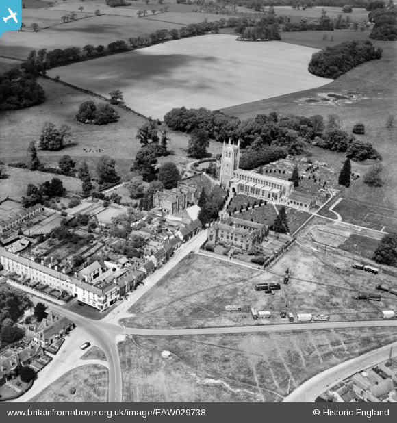
EAW029738 ENGLAND (1950). Church Walk and Holy Trinity Church, Long Melford, 1950
© Copyright OpenStreetMap contributors and licensed by the OpenStreetMap Foundation. 2024. Cartography is licensed as CC BY-SA.
Details
| Title | [EAW029738] Church Walk and Holy Trinity Church, Long Melford, 1950 |
| Reference | EAW029738 |
| Date | 30-May-1950 |
| Link | |
| Place name | LONG MELFORD |
| Parish | LONG MELFORD |
| District | |
| Country | ENGLAND |
| Easting / Northing | 586480, 246715 |
| Longitude / Latitude | 0.72215119104123, 52.086906191809 |
| National Grid Reference | TL865467 |
Pins
 Matt Aldred edob.mattaldred.com |
Tuesday 9th of March 2021 10:17:02 AM | |
 Sparky |
Monday 23rd of October 2017 06:54:41 PM | |
jrussill |
Thursday 16th of July 2015 01:56:01 PM |
User Comment Contributions
 WW2 Pillbox |
jrussill |
Thursday 16th of July 2015 01:57:32 PM |


