
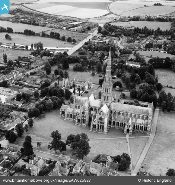
EAW025827 ENGLAND (1949). St Mary's Cathedral, Salisbury, 1949
© Copyright OpenStreetMap contributors and licensed by the OpenStreetMap Foundation. 2024. Cartography is licensed as CC BY-SA.
Nearby Images (25)
EAW025827

EAW025828
, Salisbury, 1949. This image has been produced from a damaged negative.")
EAW025831

EAW003564

EAW051974

EPW041080

EAW051967

EPW041083

EPW041084

EAW025829
, Salisbury, 1949. This image has been produced from a damaged negative.")
EAW025826

EAW025832

EAW003563

EAW051969

EPW011037

EAW051986

EAW003562

EAW051975

EPW011038

EAW051988

EAW051976

EAW051922

EAW051987

EAW051978

EAW051968

Details
| Title | [EAW025827] St Mary's Cathedral, Salisbury, 1949 |
| Reference | EAW025827 |
| Date | 10-August-1949 |
| Link | |
| Place name | SALISBURY |
| Parish | SALISBURY |
| District | |
| Country | ENGLAND |
| Easting / Northing | 414371, 129408 |
| Longitude / Latitude | -1.7948972946736, 51.063293874466 |
| National Grid Reference | SU144294 |
Pins
 clippedwings |
Friday 20th of December 2013 10:59:40 PM | |
Sorry but according to the 1953 1:2500 Ordnance Survey map of the area this is Newbridge Hospital. |
 Class31 |
Wednesday 2nd of April 2014 08:29:01 PM |
clippedwings |
Friday 20th of December 2013 10:57:18 PM | |
Sorry but this is Alderbury Union Workhouse which by the 1930's became Tower House Poor Law Institution administered by Wiltshire County Council. Most of the buildings were demolished in the mid 1970's. Odstock Hosptal is further out of Salisbury. |
Class31 |
Wednesday 2nd of April 2014 08:32:54 PM |
Class31 |
Monday 16th of December 2013 12:07:09 PM |
User Comment Contributions
 Cathedral Church of the Blessed Virgin Mary 02/04/2014 |
Class31 |
Wednesday 2nd of April 2014 08:18:11 PM |


