
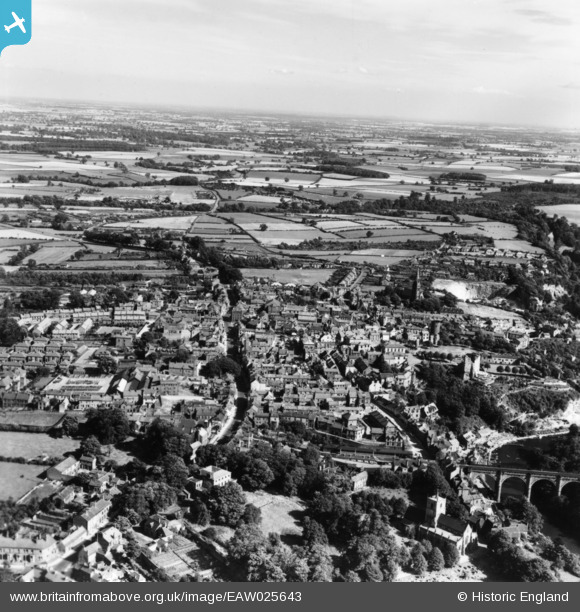
EAW025643 ENGLAND (1949). The town, Knaresborough, from the north-west, 1949. This image has been produced from a print.
© Copyright OpenStreetMap contributors and licensed by the OpenStreetMap Foundation. 2024. Cartography is licensed as CC BY-SA.
Nearby Images (10)
EAW025643

EAW025641

EPW015831

EAW025646

EAW025644

EPW015827

EAW025642

EAW025647

EPW015830

EAW025645

Details
| Title | [EAW025643] The town, Knaresborough, from the north-west, 1949. This image has been produced from a print. |
| Reference | EAW025643 |
| Date | 3-August-1949 |
| Link | |
| Place name | KNARESBOROUGH |
| Parish | KNARESBOROUGH |
| District | |
| Country | ENGLAND |
| Easting / Northing | 434846, 457141 |
| Longitude / Latitude | -1.4682347361094, 54.008920960877 |
| National Grid Reference | SE348571 |
Pins
Be the first to add a comment to this image!


