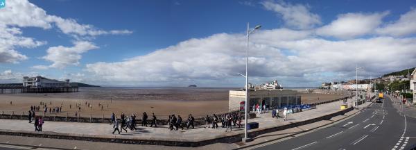
EAW025151 ENGLAND (1949). Weston Bay and the town, Weston-super-Mare, from the north, 1949

© Copyright OpenStreetMap contributors and licensed by the OpenStreetMap Foundation. 2024. Cartography is licensed as CC BY-SA.
Nearby Images (9)
EAW025151

EAW015053

EPW033277

EPW001037

EPW051708

EPW024072

EPW024076

EPW023969

EAW025150

Details
| Title | [EAW025151] Weston Bay and the town, Weston-super-Mare, from the north, 1949 |
| Reference | EAW025151 |
| Date | 25-July-1949 |
| Link | |
| Place name | WESTON-SUPER-MARE |
| Parish | WESTON-SUPER-MARE |
| District | |
| Country | ENGLAND |
| Easting / Northing | 331814, 161796 |
| Longitude / Latitude | -2.9792342728666, 51.350645189649 |
| National Grid Reference | ST318618 |
Pins
 Alan McFaden |
Saturday 28th of December 2013 07:17:37 PM | |
Alan McFaden |
Saturday 28th of December 2013 07:16:50 PM | |
Alan McFaden |
Saturday 28th of December 2013 07:15:50 PM | |
Alan McFaden |
Saturday 28th of December 2013 07:14:49 PM | |
Alan McFaden |
Saturday 28th of December 2013 07:14:10 PM |