
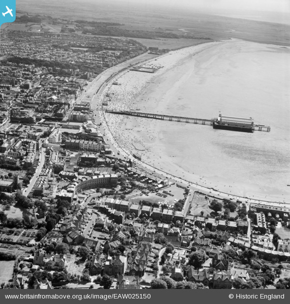
EAW025150 ENGLAND (1949). Weston Bay and the Grand Pier, Weston-super-Mare, from the north, 1949
© Copyright OpenStreetMap contributors and licensed by the OpenStreetMap Foundation. 2024. Cartography is licensed as CC BY-SA.
Nearby Images (7)
EAW025150

EPW033277

EPW001037

EPW051731

EAW015054

EAW015053

EAW025151

Details
| Title | [EAW025150] Weston Bay and the Grand Pier, Weston-super-Mare, from the north, 1949 |
| Reference | EAW025150 |
| Date | 25-July-1949 |
| Link | |
| Place name | WESTON-SUPER-MARE |
| Parish | WESTON-SUPER-MARE |
| District | |
| Country | ENGLAND |
| Easting / Northing | 331590, 161941 |
| Longitude / Latitude | -2.9824785650365, 51.351922014413 |
| National Grid Reference | ST316619 |
Pins
 Gen_Hancock |
Friday 3rd of February 2017 12:29:39 PM | |
Gen_Hancock |
Friday 3rd of February 2017 11:28:32 AM | |
 Alan McFaden |
Friday 27th of December 2013 01:01:45 PM | |
Alan McFaden |
Friday 27th of December 2013 12:46:55 PM | |
Alan McFaden |
Friday 27th of December 2013 12:45:34 PM |


