
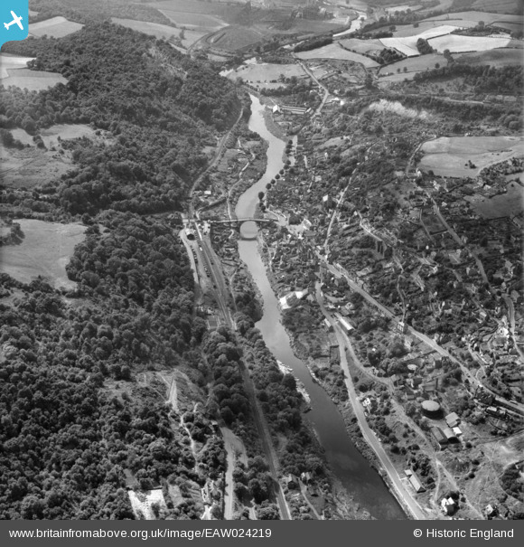
EAW024219 ENGLAND (1949). The River Severn, Iron Bridge and environs, Ironbridge, 1949
© Copyright OpenStreetMap contributors and licensed by the OpenStreetMap Foundation. 2024. Cartography is licensed as CC BY-SA.
Nearby Images (14)
EAW024219

EAW024220

EAW012586

EPW046404

EAW012671

EPW046398

EPW046406

EPW046395

EAW024221

EPW046402

EPW034286

EAW024217

EPW046401

EAW024218

Details
| Title | [EAW024219] The River Severn, Iron Bridge and environs, Ironbridge, 1949 |
| Reference | EAW024219 |
| Date | 27-June-1949 |
| Link | |
| Place name | IRONBRIDGE |
| Parish | THE GORGE |
| District | |
| Country | ENGLAND |
| Easting / Northing | 367360, 303380 |
| Longitude / Latitude | -2.4822637052757, 52.626844718556 |
| National Grid Reference | SJ674034 |
Pins
 Rog G |
Wednesday 11th of February 2015 04:58:12 PM | |
 Alan McFaden |
Friday 27th of December 2013 10:50:12 AM | |
Alan McFaden |
Friday 27th of December 2013 10:46:20 AM |

User Comment Contributions
 Ironbridge, 13/08/2015 |
 Class31 |
Sunday 29th of May 2016 12:27:29 PM |


