
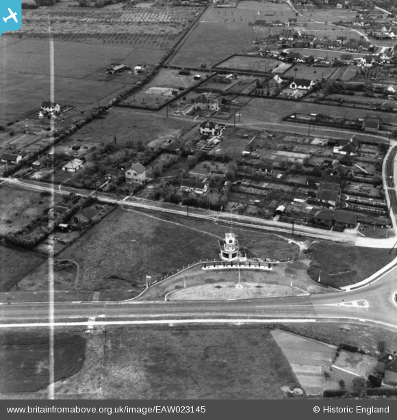
EAW023145 ENGLAND (1949). Chestfield Filling Station off Thanet Way and environs, Chestfield, 1949. This image has been produced from a print marked by Aerofilms Ltd for photo editing.
© Copyright OpenStreetMap contributors and licensed by the OpenStreetMap Foundation. 2024. Cartography is licensed as CC BY-SA.
Nearby Images (5)
EAW023145

EAW023148

EAW023144

EAW023146

EAW023147

Details
| Title | [EAW023145] Chestfield Filling Station off Thanet Way and environs, Chestfield, 1949. This image has been produced from a print marked by Aerofilms Ltd for photo editing. |
| Reference | EAW023145 |
| Date | 11-May-1949 |
| Link | |
| Place name | CHESTFIELD |
| Parish | CHESTFIELD |
| District | |
| Country | ENGLAND |
| Easting / Northing | 613683, 166668 |
| Longitude / Latitude | 1.0695520318983, 51.358328762549 |
| National Grid Reference | TR137667 |
Pins
Be the first to add a comment to this image!
User Comment Contributions
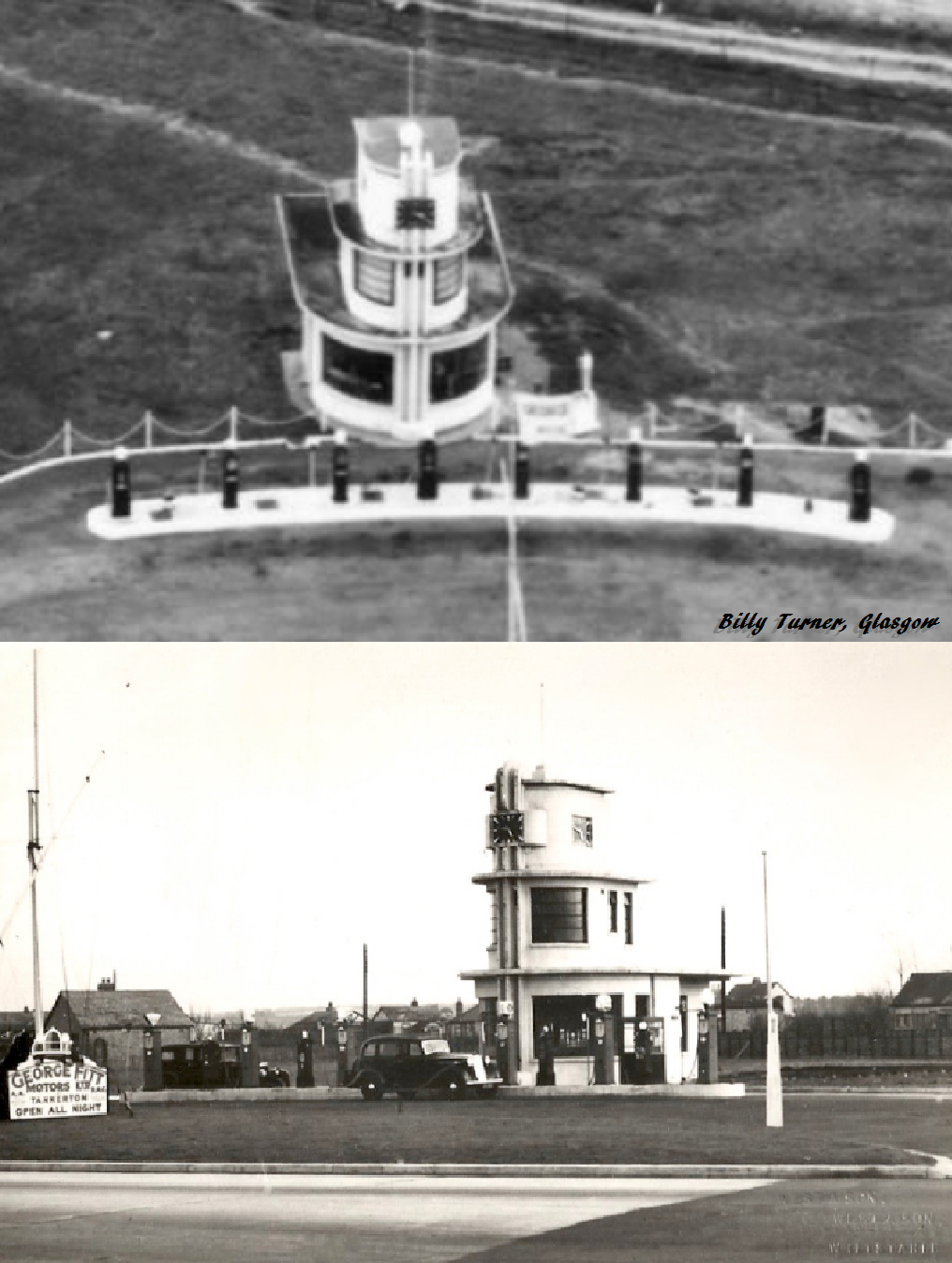 This is the old George Fitt filling station adjacent to the Chestfield roundabout. It stood on the site of what is today the Shell filling station. George Fitt was a successful local businessman who established The Marine Hotel, on the seafront, from a pair of adjoining houses in 1906 having moved from London due to poor health. He also established a successful garage business in Tankerton in 1919. |
 Billy Turner |
Tuesday 16th of May 2017 06:56:28 PM |


