
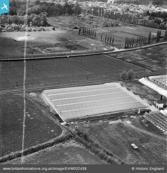
EAW022438 ENGLAND (1949). Tadburn Nursery, Romsey, 1949. This image was marked by Aerofilms Ltd for photo editing.
© Copyright OpenStreetMap contributors and licensed by the OpenStreetMap Foundation. 2024. Cartography is licensed as CC BY-SA.
Nearby Images (15)
EAW022438

EAW022436

EAW022432

EAW022435

EAW021853

EAW022439

EAW022440

EAW021855

EAW022434

EAW021851

EAW022433

EAW022437

EAW021852

EAW021854

EAW021850

Details
| Title | [EAW022438] Tadburn Nursery, Romsey, 1949. This image was marked by Aerofilms Ltd for photo editing. |
| Reference | EAW022438 |
| Date | 22-April-1949 |
| Link | |
| Place name | ROMSEY |
| Parish | ROMSEY |
| District | |
| Country | ENGLAND |
| Easting / Northing | 436200, 120773 |
| Longitude / Latitude | -1.4842260058479, 50.984678650496 |
| National Grid Reference | SU362208 |
Pins


User Comment Contributions
 Sports Centre Romsey |
 Christopher |
Monday 13th of January 2014 02:14:08 PM |


