
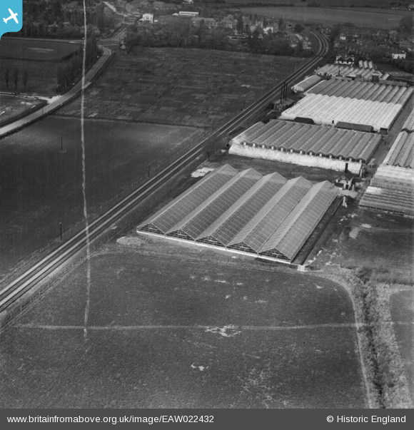
EAW022432 ENGLAND (1949). Tadburn Nursery, Romsey, 1949. This image was marked by Aerofilms Ltd for photo editing.
© Copyright OpenStreetMap contributors and licensed by the OpenStreetMap Foundation. 2024. Cartography is licensed as CC BY-SA.
Nearby Images (15)
EAW022432

EAW022435

EAW021855

EAW022439

EAW021853

EAW022434

EAW021851

EAW022438

EAW022436

EAW022440

EAW022433

EAW022437

EAW021854

EAW021852

EAW021850

Details
| Title | [EAW022432] Tadburn Nursery, Romsey, 1949. This image was marked by Aerofilms Ltd for photo editing. |
| Reference | EAW022432 |
| Date | 22-April-1949 |
| Link | |
| Place name | ROMSEY |
| Parish | ROMSEY |
| District | |
| Country | ENGLAND |
| Easting / Northing | 436232, 120765 |
| Longitude / Latitude | -1.4837708907496, 50.984604693289 |
| National Grid Reference | SU362208 |
Pins
 redmist |
Friday 23rd of December 2022 03:42:43 PM |
User Comment Contributions
 Great photo |
 Christopher |
Wednesday 25th of December 2013 07:59:01 PM |
Known to Romsonians as "The Tomato Factory" |
ecuk268 |
Wednesday 25th of December 2013 07:59:01 PM |


