
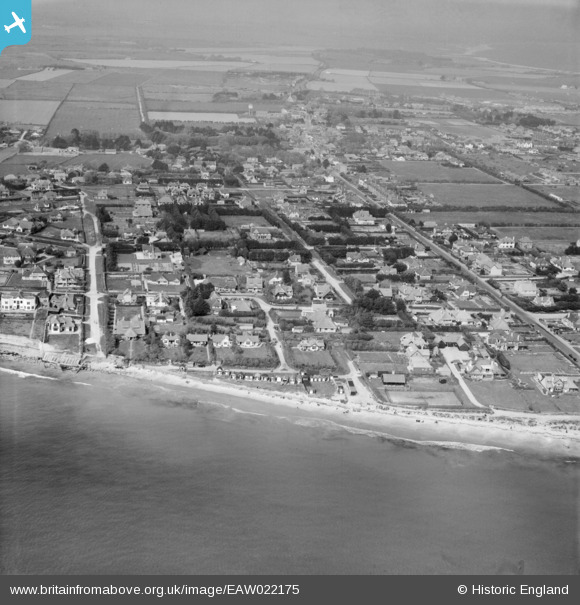
EAW022175 ENGLAND (1949). The town and the seafront, Selsey, from the south-west, 1949
© Copyright OpenStreetMap contributors and licensed by the OpenStreetMap Foundation. 2024. Cartography is licensed as CC BY-SA.
Nearby Images (4)
EAW022175

EAW022172

EAW022171

EAW022174

Details
| Title | [EAW022175] The town and the seafront, Selsey, from the south-west, 1949 |
| Reference | EAW022175 |
| Date | 17-April-1949 |
| Link | |
| Place name | SELSEY |
| Parish | SELSEY |
| District | |
| Country | ENGLAND |
| Easting / Northing | 484885, 92482 |
| Longitude / Latitude | -0.79724581465072, 50.725178823317 |
| National Grid Reference | SZ849925 |


