
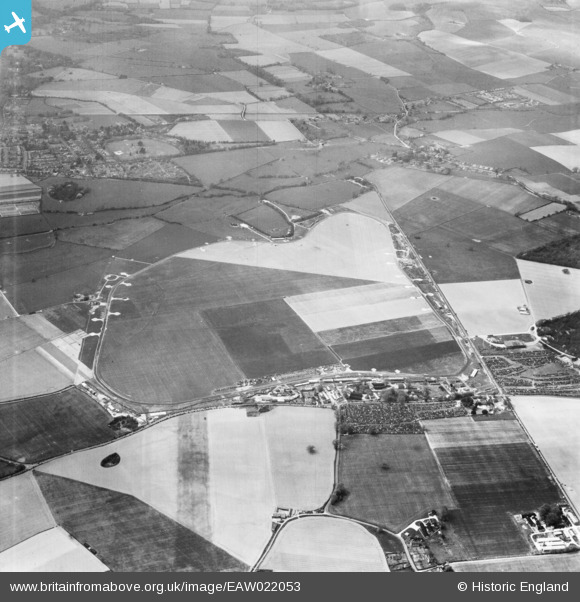
EAW022053 ENGLAND (1949). Westhamptnett, Goodwood Motor Circuit on a race day, from the east, 1949
© Copyright OpenStreetMap contributors and licensed by the OpenStreetMap Foundation. 2024. Cartography is licensed as CC BY-SA.
Nearby Images (6)
EAW022053

EAW022070

EAW022065

EAW022071

EAW022064

EAW022062

Details
| Title | [EAW022053] Westhamptnett, Goodwood Motor Circuit on a race day, from the east, 1949 |
| Reference | EAW022053 |
| Date | 14-April-1949 |
| Link | |
| Place name | WESTHAMPNETT |
| Parish | WESTHAMPNETT |
| District | |
| Country | ENGLAND |
| Easting / Northing | 487971, 107288 |
| Longitude / Latitude | -0.74998437204345, 50.857847236484 |
| National Grid Reference | SU880073 |
Pins
 BARRIE |
Sunday 27th of October 2019 01:13:20 PM | |
DUDLEY |
Sunday 15th of February 2015 08:28:31 PM | |
MADJEZ |
Saturday 28th of June 2014 10:49:23 AM |
User Comment Contributions
 Goodwood. |
Scorrybreck |
Sunday 16th of March 2014 09:13:01 PM |


