
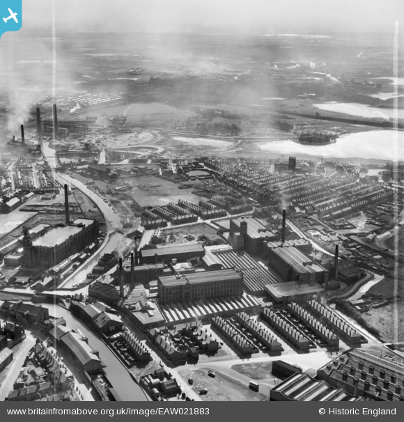
EAW021883 ENGLAND (1949). The Western and the Swan Meadow Cotton Mills, Wigan, from the north-west, 1949. This image was marked by Aerofilms Ltd for photo editing.
© Copyright OpenStreetMap contributors and licensed by the OpenStreetMap Foundation. 2024. Cartography is licensed as CC BY-SA.
Nearby Images (8)
EAW021883

EAW021884

EAW021885

EAW021886

EAW021887

EAW021882

EPW005021

EAW021881

Details
| Title | [EAW021883] The Western and the Swan Meadow Cotton Mills, Wigan, from the north-west, 1949. This image was marked by Aerofilms Ltd for photo editing. |
| Reference | EAW021883 |
| Date | 8-April-1949 |
| Link | |
| Place name | WIGAN |
| Parish | |
| District | |
| Country | ENGLAND |
| Easting / Northing | 357592, 405125 |
| Longitude / Latitude | -2.6400048082961, 53.540810338958 |
| National Grid Reference | SD576051 |
Pins
 Paul Williams |
Wednesday 3rd of January 2024 05:09:57 PM | |
Neil Linford |
Friday 24th of July 2015 06:09:12 PM | |
Eddie |
Friday 6th of June 2014 05:03:08 PM | |
Eddie |
Friday 6th of June 2014 05:01:34 PM |


