
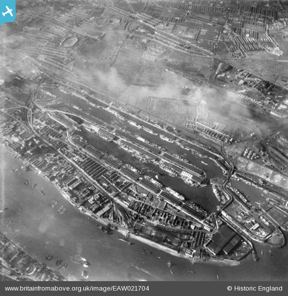
EAW021704 ENGLAND (1949). The Royal Albert Dock and the King George V Dock, North Woolwich, 1949. This image has been produced from a print.
© Copyright OpenStreetMap contributors and licensed by the OpenStreetMap Foundation. 2024. Cartography is licensed as CC BY-SA.
Nearby Images (16)
EAW021704

EAW000037

EAW021713

EAW008727

EAW021702

EPW010729

EAW022354

EPW005310

EPW044119

EPW032937

EAW021703

EAW022359

EAW008725

EPW010727

EAW000035

EPW021370

Details
| Title | [EAW021704] The Royal Albert Dock and the King George V Dock, North Woolwich, 1949. This image has been produced from a print. |
| Reference | EAW021704 |
| Date | 26-March-1949 |
| Link | |
| Place name | NORTH WOOLWICH |
| Parish | |
| District | |
| Country | ENGLAND |
| Easting / Northing | 542998, 180561 |
| Longitude / Latitude | 0.060651854375819, 51.505381964477 |
| National Grid Reference | TQ430806 |
Pins
Be the first to add a comment to this image!


