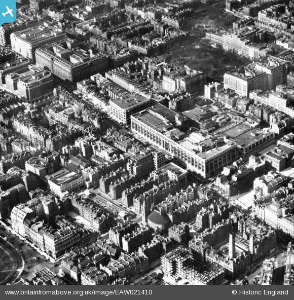
EAW021410 ENGLAND (1949). Selfridges and environs, Marylebone, 1949. This image has been produced from a print.
© Copyright OpenStreetMap contributors and licensed by the OpenStreetMap Foundation. 2024. Cartography is licensed as CC BY-SA.
Nearby Images (40)
EAW021410

EPW021936

EAW021409

EPW021935

EPW006306

EPW046655

EAW021411

EAW050867

EAW050837

EAW021412

EPW021967

EAW050871

EAW021408

EPW046656

EPW060755

EPW045400

EPW060765

EPW045399

EAW052483

EAW052482

EAW050854

EPW021880

EAW050868

EPR000431

EAW050850

EPW011416

EAW000563

EPW059412

EAW000564

EPW021405

EPW047237

EAW052484

EAW052481

EAW050839

EPW021436

EAW025864

EAW029834

EAW025864A
, Mayfair, 1949. This image has been produced from a copy-negative.")
EAW042622

EAW030118

Details
| Title | [EAW021410] Selfridges and environs, Marylebone, 1949. This image has been produced from a print. |
| Reference | EAW021410 |
| Date | 15-March-1949 |
| Link | |
| Place name | MARYLEBONE |
| Parish | |
| District | |
| Country | ENGLAND |
| Easting / Northing | 528253, 181081 |
| Longitude / Latitude | -0.15151386704749, 51.513595079072 |
| National Grid Reference | TQ283811 |
Pins
 brianbeckett |
Tuesday 21st of October 2014 07:59:26 PM | |
brianbeckett |
Tuesday 21st of October 2014 07:57:57 PM | |
 Alan McFaden |
Thursday 11th of September 2014 09:05:21 AM | |
Alan McFaden |
Thursday 11th of September 2014 09:04:53 AM | |
Alan McFaden |
Thursday 11th of September 2014 09:04:15 AM |