
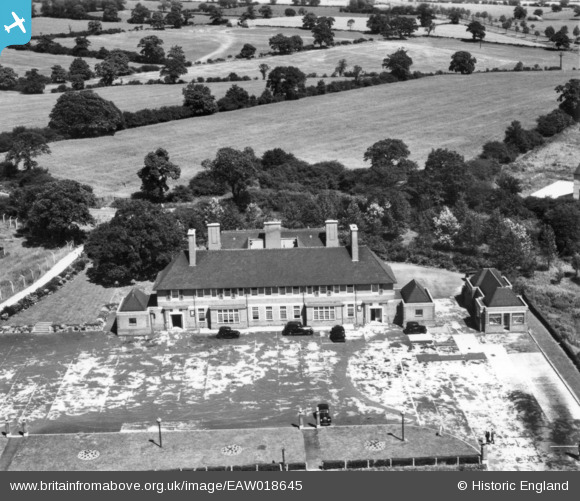
EAW018645 ENGLAND (1948). The Elstree Way Hotel, Borehamwood, 1948. This image has been produced from a print.
© Copyright OpenStreetMap contributors and licensed by the OpenStreetMap Foundation. 2024. Cartography is licensed as CC BY-SA.
Nearby Images (17)
EAW018645

EAW018646

EAW023308

EAW013213

EAW017174

EAW044306

EAW023313

EAW044444

EAW044446

EAW031634

EAW013214

EAW023314

EAW010077

EAW010079

EAW010078

EAW017173

EAW023311

Details
| Title | [EAW018645] The Elstree Way Hotel, Borehamwood, 1948. This image has been produced from a print. |
| Reference | EAW018645 |
| Date | 10-September-1948 |
| Link | |
| Place name | BOREHAMWOOD |
| Parish | ELSTREE AND BOREHAMWOOD |
| District | |
| Country | ENGLAND |
| Easting / Northing | 520890, 197067 |
| Longitude / Latitude | -0.25207432849347, 51.658904266684 |
| National Grid Reference | TQ209971 |
Pins
Be the first to add a comment to this image!


