
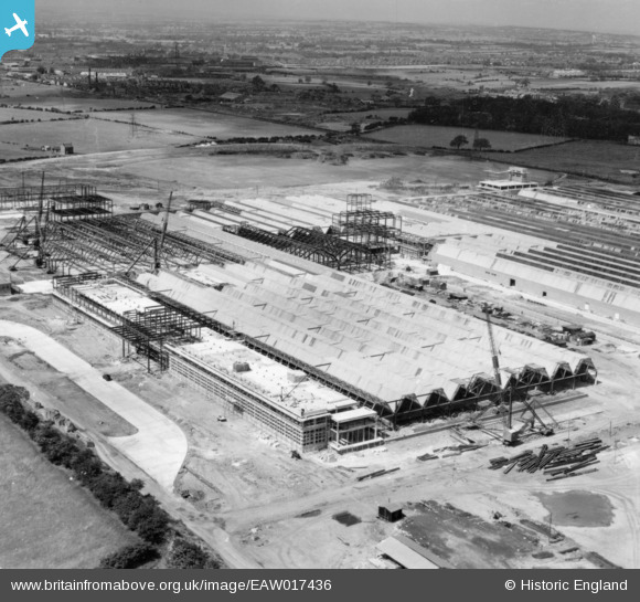
EAW017436 ENGLAND (1948). The Patons and Baldwins Worsted Spinning Mill under construction, Darlington, from the south-east, 1948. This image has been produced from a print.
© Copyright OpenStreetMap contributors and licensed by the OpenStreetMap Foundation. 2024. Cartography is licensed as CC BY-SA.
Nearby Images (48)
EAW017436

EAW017437

EAW022814

EAW022812

EAW022804

EAW034281

EAW034282

EAW017433

EAW022817

EAW027433

EAW023502

EAW027452

EAW017429

EAW007626

EAW027444

EAW022808

EAW034279

EAW007625

EAW027447

EAW017432

EAW022802

EAW007630

EAW013818

EAW007631

EAW007624

EAW027436

EAW007632

EAW007636

EAW007635

EAW022815

EAW022810

EAW027454

EAW034280

EAW007637

EAW034272

EAW027457

EAW017430

EAW027442

EAW023497

EAW017435

EAW013819

EAW022813

EAW017438

EAW027437

EAW023501

EAW034273

EAW023503

EAW023504

Details
| Title | [EAW017436] The Patons and Baldwins Worsted Spinning Mill under construction, Darlington, from the south-east, 1948. This image has been produced from a print. |
| Reference | EAW017436 |
| Date | 24-July-1948 |
| Link | |
| Place name | DARLINGTON |
| Parish | |
| District | |
| Country | ENGLAND |
| Easting / Northing | 431617, 514825 |
| Longitude / Latitude | -1.5114152423896, 54.527591757601 |
| National Grid Reference | NZ316148 |
Pins
Be the first to add a comment to this image!


