
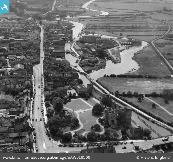
EAW016509 ENGLAND (1948). Newark Castle and Castle Gardens, the River Trent and Castle Gate, Newark-on-Trent, 1948. This image has been produced from a print.
© Copyright OpenStreetMap contributors and licensed by the OpenStreetMap Foundation. 2024. Cartography is licensed as CC BY-SA.
Nearby Images (20)
EAW016509

EAW006306

EAW016511

EAW016508

EPW015268

EPW013025

EAW006304

EAW013672

EPW015267

EAW006303

EPW016193

EAW006307

EPW016194

EAW006308

EAW016512

EPW038063

EPW038061

EAW013673

EPW038062

EAW016510

Details
| Title | [EAW016509] Newark Castle and Castle Gardens, the River Trent and Castle Gate, Newark-on-Trent, 1948. This image has been produced from a print. |
| Reference | EAW016509 |
| Date | 9-November-1948 |
| Link | |
| Place name | NEWARK-ON-TRENT |
| Parish | NEWARK |
| District | |
| Country | ENGLAND |
| Easting / Northing | 479520, 353914 |
| Longitude / Latitude | -0.8128567281832, 53.07622789429 |
| National Grid Reference | SK795539 |


