
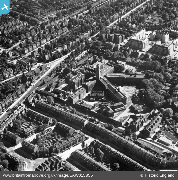
EAW015855 ENGLAND (1948). HM Prison Holloway, Tufnell Park, 1948. This image has been produced from a print.
© Copyright OpenStreetMap contributors and licensed by the OpenStreetMap Foundation. 2024. Cartography is licensed as CC BY-SA.
Nearby Images (15)
EAW015855

EPW053670

EAW005467

EAW005458

EAW005450

EAW005453

EAW005457

EAW005456

EAW005459

EAW005455

EAW005451

EAW005461

EAW005466

EAW005449

EAW005448

Details
| Title | [EAW015855] HM Prison Holloway, Tufnell Park, 1948. This image has been produced from a print. |
| Reference | EAW015855 |
| Date | 19-May-1948 |
| Link | |
| Place name | TUFNELL PARK |
| Parish | |
| District | |
| Country | ENGLAND |
| Easting / Northing | 530092, 185603 |
| Longitude / Latitude | -0.12335282749784, 51.553816613139 |
| National Grid Reference | TQ301856 |
Pins
 Class31 |
Saturday 28th of March 2015 07:54:05 PM | |
 billyfern |
Saturday 4th of October 2014 04:15:39 PM | |
billyfern |
Saturday 4th of October 2014 04:15:02 PM | |
billyfern |
Saturday 4th of October 2014 04:14:42 PM | |
billyfern |
Saturday 4th of October 2014 04:14:07 PM | |
billyfern |
Saturday 4th of October 2014 04:13:36 PM | |
billyfern |
Saturday 4th of October 2014 04:13:15 PM |

User Comment Contributions
 HM Prison, Holloway, 10/03/2015 |
Class31 |
Saturday 28th of March 2015 07:53:20 PM |


